Snow, rain and sleet set to hit Lancashire as Met Office issues new weather warning
and live on Freeview channel 276
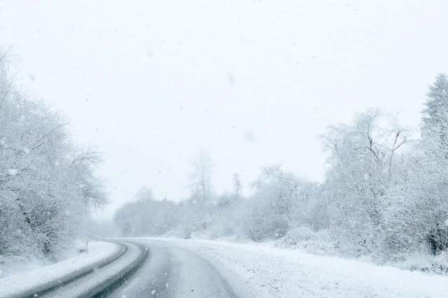
Weather experts predict wintry showers will fall onto frozen surfaces this week, resulting in "slippery conditions and perhaps some disruption to travel."
The warning, which is in place from 5pm tomorrow (January 7) until 11am on Friday (January 8), covers all of the county, including Preston, Lancaster, Blackpool, Fylde, Wyre, South Ribble, Ribble Valley, West Lancashire, Chorley, Rossendale, Blackburn with Darwen, Hyndburn, Burnley and Pendle.
Advertisement
Hide AdAdvertisement
Hide AdA spokesman for the Met Office said: "Showers, a mixture of rain sleet and snow, are expected to fall onto frozen surfaces leading to icy stretches forming.
"In addition, a more persistent spell of rain and hill snow is likely to spread south across northern England and north Wales during Thursday evening and night.
"Whilst ice is expected to be the main hazard, snow is likely in place too. Snow is most likely to fall over The Pennines, North York Moors and the high ground of Wales, with 1-3cm possible here. Elsewhere, whilst some snowfall is possible, accumulations are likely to be slight and temporary."
Here's what to expect:
- Some injuries from slips and falls on icy surfaces

- Probably some icy patches on some untreated roads, pavements and cycle paths
Advertisement
Hide AdAdvertisement
Hide AdHere is the full Met Office weather forecast for the North West:
Today (January 6):
Scattered, wintry showers are likely during the morning, especially in eastern areas, leading to icy conditions. These showers will ease during the afternoon, becoming dry and bright. Remaining cold despite sunny spells and light winds. Maximum temperature 4 °C.
Tonight (January 6):
Staying dry through the evening and overnight. Largely clear skies will cause very cold temperatures, bringing a risk of freezing fog patches and icy conditions. Light winds. Minimum temperature -6 °C.
Thursday (January 7):
A bright and frosty start, but with some areas of freezing fog which will be slow to clear. Increasingly cloudy with outbreaks of light rain and snow by the afternoon. Maximum temperature 3 °C.
Outlook for Friday to Sunday (January 8 - January 10):
Advertisement
Hide AdAdvertisement
Hide AdA few outbreaks of rain, sleet and snow on Friday, then drier on Saturday. Staying cold both days, with sunny spells and overnight frosts. Cloudy and milder on Sunday.
Support us and become a subscriber today. Enjoy unlimited access to local news, the latest football stories and new puzzles every day. With a digital subscription, you can see fewer ads, enjoy faster load times, and get access to exclusive newsletters and content. Click here to subscribe.
Comment Guidelines
National World encourages reader discussion on our stories. User feedback, insights and back-and-forth exchanges add a rich layer of context to reporting. Please review our Community Guidelines before commenting.